Need well service in Waxahachie?

DFW Well Service helps property owners with water well drilling, pump service, inspections, and related well issues across North Texas.

Welcome to Waxahachie, TX — DFW Well Service serves Waxahachie and Ellis County

Water Well Drilling & Pump Repair in Waxahachie, TX | DFW Well Service

Service Area Overview

Licensed well drilling and pump service in Waxahachie, TX. Woodbine is the primary Ellis County residential aquifer; Trinity is deep here.

Services We Provide in Waxahachie

DFW Well Service (TDLR License #61234 DKMPW) provides water well drilling and complete well services for residential and rural customers in Waxahachie and throughout Ellis County.

Well Depth & Geology in Waxahachie Area

Isometric geological cross-section cube illustration showing Ellis County, Texas stratigraphy — Topsoil, Taylor Group / younger Upper Cretaceous marl, chalk, and clay, Austin Chalk, Eagle Ford Shale, Woodbine Formation / Woodbine Aquifer, Washita and Fredericksburg Groups, and the Woodbine aquifer at the base.

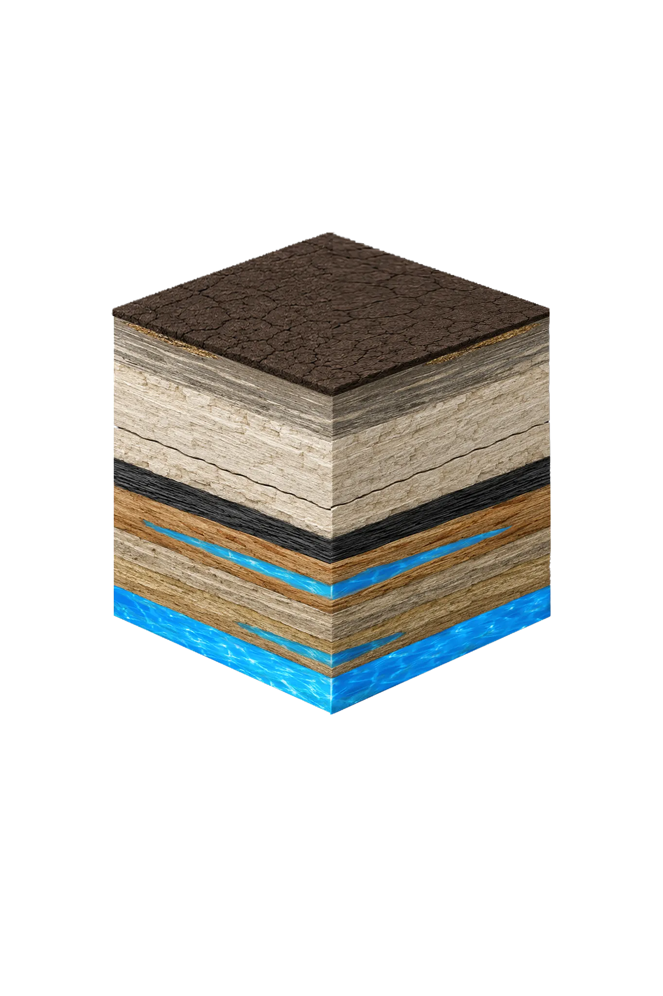
Tap any layer in the cube — or in the list below — to see what it is and what it means for drilling a well here.

  1. Topsoil — Blackland Prairie (Houston Black)
    0–15 ft
  2. Austin Chalk
    varies
  3. Eagle Ford Shale
    below Austin Chalk
  4. Woodbine Formation / Woodbine Aquifer
    100–1,400 (variable across county) ft
  5. Trinity Group: Paluxy / Glen Rose / Hensell / Hosston (= Twin Mountains)
    ~2,000–3,000 (Hosston/Twin Mountains) ft
Tap or hover a layer in the cube to see what's beneath the surface here.

This cross-section shows the layer stack typical of Ellis County. The exact formations and depths under a specific Waxahachie-area property vary — see the details above.

Explore the full Ellis County geology →

Primary Aquifer
Woodbine

Secondary: Trinity (deep — Hosston/Twin Mountains at ~2,000–3,000 ft)

Typical Well Depth
Varies by location

We estimate from nearby well records

Groundwater District
Prairielands GCD
Confinement
deep confined subcrop; ~100–1,400 ft beneath Ellis County

Ellis County overview → Permit & regulations → TDLR License #61234 DKMPW Updated June 4, 2026

Wells around Waxahachie draw mainly from the Woodbine, the primary residential aquifer across Ellis County, with the deeper Trinity as a secondary target below it. Waxahachie sits on Austin Chalk bedrock in central Ellis County; the Woodbine has a regional thickness of roughly 100–1,400 feet, and the deeper Trinity sands (the Twin Mountains and Paluxy) reach roughly 2,000–3,000 feet down here. Many Waxahachie properties are on municipal water, so private wells are more common on rural acreage outside the city.

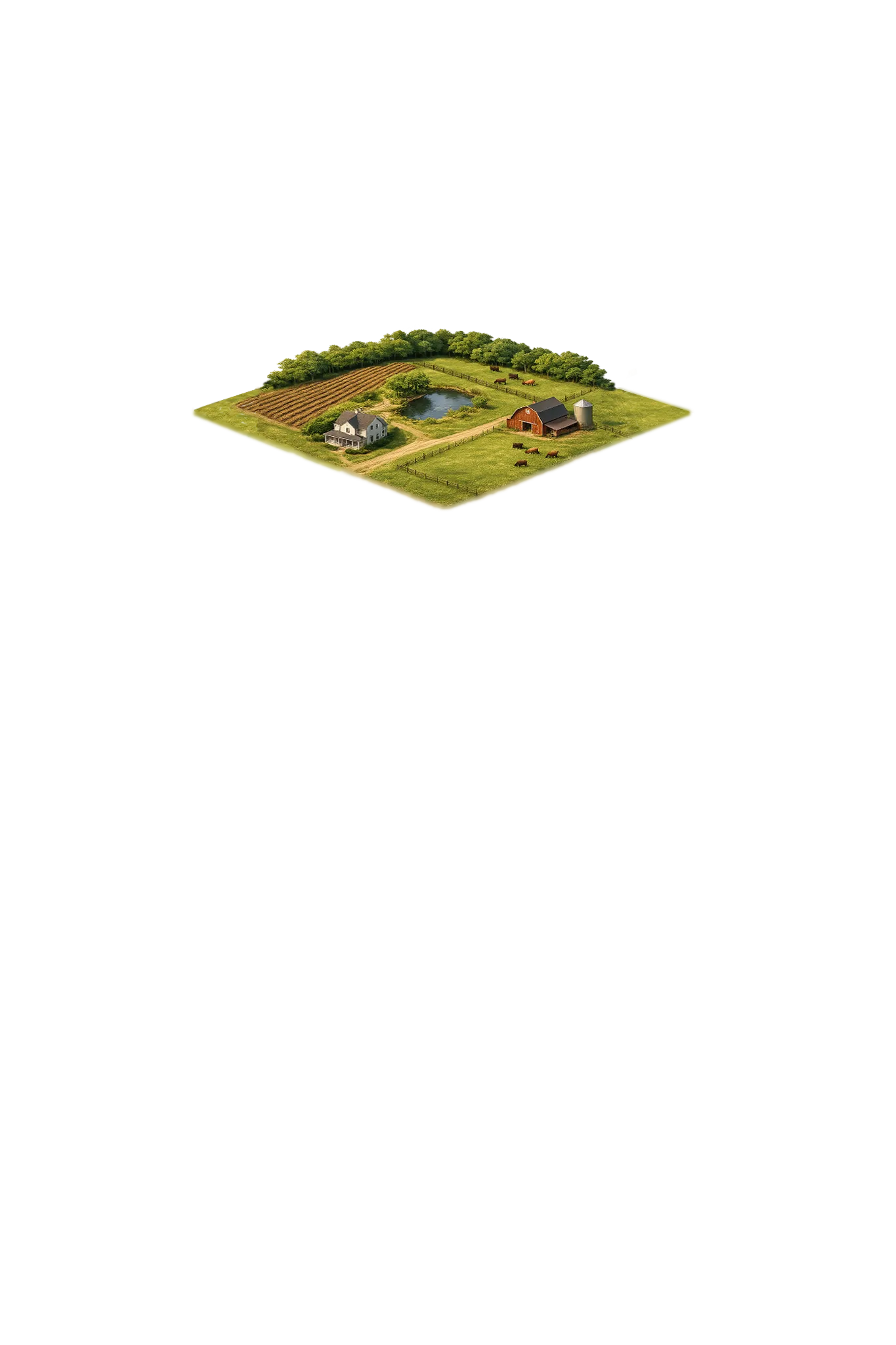
Waxahachie’s position as Ellis County seat and a growing suburban center means well service needs range from historic rural homesteads with decades-old equipment to newly drilled wells on acreage lots at the edges of city growth. We serve the full spectrum.

Ellis County Permit Requirements

Water wells in Waxahachie and Ellis County are regulated by TDLR and the Prairielands Groundwater Conservation District. The Prairielands GCD requires a permit application before drilling begins and a well completion report after the work is done. Setback distances from structures, septic systems, and surface water must be respected.

For more information on local regulations, see our guide to Ellis County water well regulations.

Call DFW Well Service at (940) 536-8560 for a free estimate on well drilling, pump repair, water testing, or any well service in the Waxahachie area. We’ll come out, assess your situation, and give you straightforward pricing with no obligation.

Frequently Asked Questions

Does Waxahachie have city water, or do residents use private wells?
Waxahachie has a municipal water system serving most of the city. However, properties in the rural areas surrounding Waxahachie — including many of the acreage tracts and smaller communities in unincorporated Ellis County — rely on private wells. Even within city limits, some older properties have existing wells used for irrigation or as a backup supply.
How deep are wells in Waxahachie and Ellis County?
There's no single typical depth across Ellis County — it varies meaningfully from one property to the next, so we review the driller's logs from neighboring wells and check public-water availability before quoting a project. Ellis County wells are generally deep: in central Ellis around Waxahachie, the Woodbine is the main residential aquifer, while the deeper Trinity (the Twin Mountains and Paluxy sands) is a secondary target that sits roughly 2,000–3,000 feet down. Many Waxahachie properties are on municipal water, so private wells are more common out on rural acreage.
What aquifer serves Waxahachie?
Waxahachie-area wells mainly target the Woodbine — a productive sandstone and the most common residential aquifer in Ellis County — with the deeper Trinity as the alternative below it. The Woodbine generally gives good residential yields, though it sits a few hundred feet down or more here, not at the surface.
What does well drilling cost in Waxahachie?
Ellis County drilling costs run approximately $32–$45 per foot. Final cost depends on completion depth and the full system (casing, pump, pressure tank, electrical). Trinity completions are substantially deeper than Woodbine completions. We provide a free itemized written estimate after reviewing neighboring driller's logs for your parcel.
Do I need a permit for a water well in Ellis County?
Yes. Wells in Ellis County require permits from both TDLR and the Prairielands Groundwater Conservation District. We handle all permitting on behalf of our customers and file the required post-completion reports.
My Waxahachie area well is over 30 years old — should I get it inspected?
Definitely. Wells that age may have corroded casing, deteriorating seals, older pump equipment, or changes in water quality over time. An inspection lets you identify issues before they become emergencies, and can determine whether rehabilitation or replacement is the more cost-effective path forward.
Is the well water in Waxahachie salty or brackish?
It varies across Ellis County. Texas Water Development Board data shows the Woodbine — the main aquifer — is fresher in the northwest (near Midlothian) and saltier toward the southeast (near Ennis), and most well water here exceeds the EPA's secondary 500 mg/L standard for total dissolved solids (a measure of how mineral-heavy the water is). Around Waxahachie, a full water-quality test is important and treatment is common.

Request Service

Tell us about the property and what you need help with.

Fields marked * are required.