Planning a well in Rockwall County?
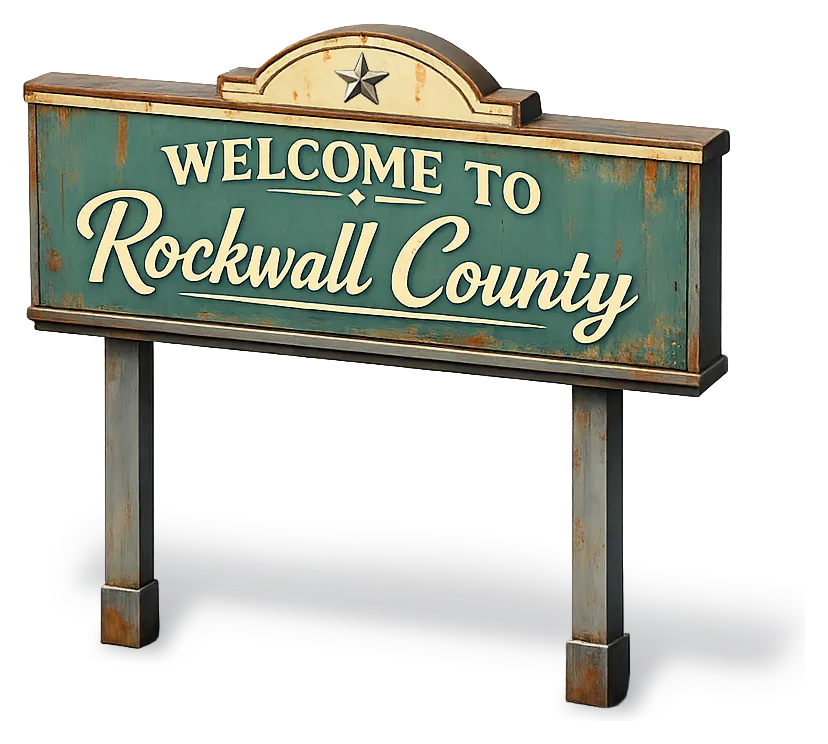
Water Well Drilling & Service in Rockwall County, Texas
Rockwall County sits over the Woodbine (subsurface) aquifer system (deep, downdip, brackish — not a practical residential target; TWDB modeled-available-groundwater value is zero acre-feet/yr for 2020–2080). Most residential wells target the Woodbine Group; depth varies meaningfully across the county and is best estimated from neighboring TWDB well records. Rockwall County sits outside all groundwater conservation districts — TDLR standards govern. Local water quality consideration: TWDB's modeled-available-groundwater value is zero acre-feet a year for both the Trinity and the Woodbine across the 2020–2080 planning horizon.
What’s Under Rockwall County: a Layer-by-Layer Look
About this diagram
This cross-section shows the actual rock formations beneath Rockwall County, from topsoil down to the Woodbine (subsurface) aquifer system.
Tap any layer in the image, or any layer in the list, to explore each layer and what it means for drilling a well on your property.
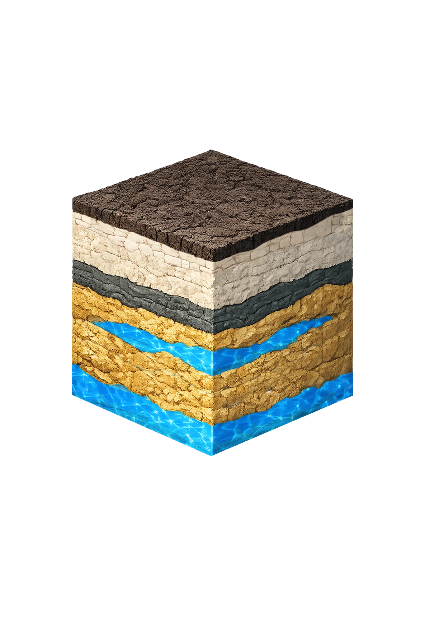
- Topsoil — Blackland Prairie vertisol (deepest, richest in service area)0–18 ft
- Austin Chalk18–200 ft
- Eagle Ford Shale200–250 ft
- Woodbine Formation250–500 ft
Rockwall County stratigraphy — top to bottom
- Topsoil — Blackland Prairie vertisol (deepest, richest in service area)
- Dark black clay that swells and shrinks with moisture (shrink-swell).
- Austin Chalk
- Austin Chalk — chalk and limestone; a confining unit, not a dependable aquifer in Rockwall County.
- Eagle Ford Shale
- Eagle Ford Shale — dark shale beneath the Austin Chalk; a confining unit, not water-bearing.
- Woodbine Formation
- A regional minor aquifer, but buried deep and brackish beneath Rockwall County — not a routine residential source (state planning value is zero acre-feet/yr).
0–18 ft
18–200 ft
200–250 ft
250–500 ft
Rockwall County stratigraphy — top to bottom
- Topsoil — Blackland Prairie vertisol (deepest, richest in service area) (0–18 ft)
- Dark black clay that swells and shrinks with moisture (shrink-swell).
- Austin Chalk (18–200 ft)
- Austin Chalk — chalk and limestone; a confining unit, not a dependable aquifer in Rockwall County.
- Eagle Ford Shale (200–250 ft)
- Eagle Ford Shale — dark shale beneath the Austin Chalk; a confining unit, not water-bearing.
- Woodbine Formation (250–500 ft)
- A regional minor aquifer, but buried deep and brackish beneath Rockwall County — not a routine residential source (state planning value is zero acre-feet/yr).
Rockwall County Quick Facts
- Primary Aquifer
- Woodbine (subsurface)
- Typical Well Depth
- Varies by location
- Groundwater District
- No GCD — TDLR standards only
- Confinement
- deep, downdip, brackish — not a practical residential target; TWDB modeled-available-groundwater value is zero acre-feet/yr for 2020–2080
We estimate from nearby well records
Water Quality Notes
- TWDB's modeled-available-groundwater value is zero acre-feet a year for both the Trinity and the Woodbine across the 2020–2080 planning horizon
- Private wells are exceedingly rare; for nearly every property the realistic source is treated city water on an NTMWD-connected system
- Total dissolved solids (TDS, how mineral-heavy water is) are high in both the Woodbine and the deep Trinity, and the county lies in TWDB's brackish-Woodbine study area — brackish meaning slightly salty water that needs treatment
- Sulfate and chloride can top EPA secondary drinking-water standards in deep targets, and the deep Trinity water is typically high in sodium
- Any shallow river-laid (alluvial) water near Lake Ray Hubbard or the East Fork Trinity is affected by surface water and site-specific
What's Under Rockwall County: the Geology Story
Drilling in Rockwall County means starting in topsoil, working through Quaternary alluvium / terrace (localized), Taylor / Navarro Group, Austin Chalk / Eagle Ford, to reach the Woodbine Group — the producing zone for most domestic wells.
For nearly every property in Rockwall County the realistic water source is treated city water on an NTMWD-connected system, not a private well. The Texas Water Development Board's 2021 modeled-available-groundwater values for both the Trinity and the Woodbine are zero acre-feet per year for the 2020–2080 planning horizon. That does not mean there is not a drop of water under the county — it means the state's adopted planning figure for those aquifer-and-county pairings is zero. Private wells are exceedingly rare, and any one well's depth and yield are highly site-specific. Before assuming a well is feasible, talk to a licensed driller and review nearby well logs for your specific tract.
The full layer-by-layer stratigraphy is laid out under the cube above. Well depth in Rockwall County varies by property location and overburden thickness; your driller can review TWDB records for neighboring wells to refine the expected completion zone before drilling.
Permits & Regulations in Rockwall County
Rockwall County sits outside all groundwater conservation districts. TDLR well construction standards govern, and your driller must be TDLR-licensed.
Full Rockwall County permit & regulations →Frequently Asked Questions about Rockwall County Wells
What aquifer is under Rockwall County?
How deep are wells typically drilled in Rockwall County?
What water quality issues are common in Rockwall County wells?
Does Rockwall County require a permit to drill a water well?
What's the main producing formation in Rockwall County?
Ready to drill or service a well in Rockwall County?
Most calls answered same business day. Licensed TDLR driller.
Request Well Service or a Drilling Estimate
Tell us a little about your property and what you need help with. We respond within a few hours during business hours.