Planning a well in Johnson County?
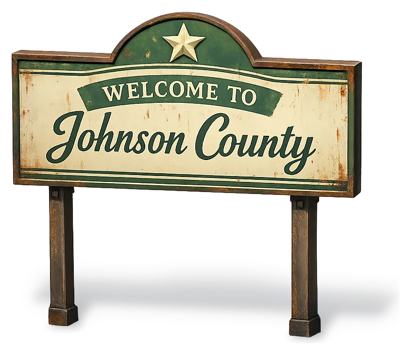
Water Well Drilling & Service in Johnson County, Texas
Johnson County sits over the Trinity (Paluxy / Glen Rose / Hensell / Hosston) aquifer system (outcrop/shallow subcrop in western Johnson County; deep confined beneath Eagle Ford/Austin Chalk in eastern Johnson County). Most residential wells target the Paluxy Sand (Trinity upper unit); depth varies meaningfully across the county and is best estimated from neighboring TWDB well records. Drilling is regulated by the Prairielands GCD, which requires a pre-drilling permit. Local water quality consideration: Hard water from dissolved calcium carbonate.
What’s Under Johnson County: a Layer-by-Layer Look
About this diagram
This cross-section shows the actual rock formations beneath Johnson County, from topsoil down to the Trinity (Paluxy / Glen Rose / Hensell / Hosston) aquifer system.
Tap any layer in the image, or any layer in the list, to explore each layer and what it means for drilling a well on your property.
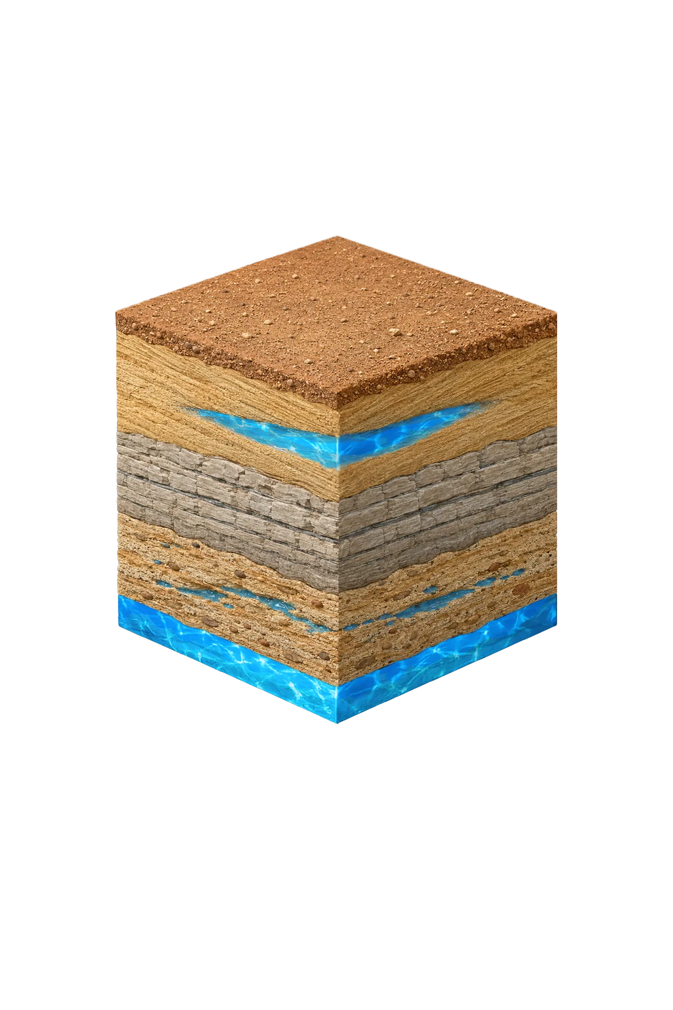
- Topsoil — Blackland Prairie / Cross Timbers fringe0–15 ft
- Paluxy Sand (Trinity upper unit)outcrop west; deep east
- Glen Rose Formationbelow Paluxy
- Hosston Conglomerate (Trinity basal sand; = Twin Mountains)deepest Trinity
Johnson County stratigraphy — top to bottom
- Topsoil — Blackland Prairie / Cross Timbers fringe
- Dark black clay in the east (it swells and shrinks with moisture), giving way to sandier Cross Timbers loam in the west.
- Paluxy Sand (Trinity upper unit)
- The Trinity layer most actively pumped in Johnson County (Prairielands GCD planning). It is at or near the surface in the west and lies deep beneath confining layers in the east. The rock is buff-to-tan sandstone.
- Glen Rose Formation
- Middle Trinity limestone and shale — a confining, less-productive layer. Note the Glen Rose is present here in Johnson County, unlike Cooke County and northern Denton County where it is missing.
- Hosston Conglomerate (Trinity basal sand; = Twin Mountains)
- The deepest Trinity layer and the most productive once a well reaches it — the same basal sand-and-conglomerate called the Twin Mountains in north-central Texas.
0–15 ft
outcrop west; deep east
below Paluxy
deepest Trinity
Johnson County stratigraphy — top to bottom
- Topsoil — Blackland Prairie / Cross Timbers fringe (0–15 ft)
- Dark black clay in the east (it swells and shrinks with moisture), giving way to sandier Cross Timbers loam in the west.
- Paluxy Sand (Trinity upper unit) (outcrop west; deep east)
- The Trinity layer most actively pumped in Johnson County (Prairielands GCD planning). It is at or near the surface in the west and lies deep beneath confining layers in the east. The rock is buff-to-tan sandstone.
- Glen Rose Formation (below Paluxy)
- Middle Trinity limestone and shale — a confining, less-productive layer. Note the Glen Rose is present here in Johnson County, unlike Cooke County and northern Denton County where it is missing.
- Hosston Conglomerate (Trinity basal sand; = Twin Mountains) (deepest Trinity)
- The deepest Trinity layer and the most productive once a well reaches it — the same basal sand-and-conglomerate called the Twin Mountains in north-central Texas.
Johnson County Quick Facts
- Primary Aquifer
- Trinity (Paluxy / Glen Rose / Hensell / Hosston)
- Typical Well Depth
- Varies by location
- Groundwater District
- Prairielands GCD
- Confinement
- outcrop/shallow subcrop in western Johnson County; deep confined beneath Eagle Ford/Austin Chalk in eastern Johnson County
Secondary: Woodbine (subsurface across central and eastern Johnson County)
We estimate from nearby well records
Water Quality Notes
- Hard water from dissolved calcium carbonate
- Higher total dissolved solids (TDS, how mineral-heavy the water is) downdip (farther down where the layers tilt deeper) — eastern Johnson County, the deep Trinity, and the deep Woodbine
- Iron and manganese, common where the Trinity reaches the surface (its outcrop) and in the Woodbine
- Occasional hydrogen sulfide (a rotten-egg smell)
Cities We Serve in Johnson County
Burleson, TX
Licensed well drilling and pump service in Burleson — a cross-county area straddling Johnson (Prairielands GCD) and Tarrant (Northern Trinity GCD).
View Burleson details →Cleburne, TX
Licensed well drilling and pump service in Cleburne and Johnson County under Prairielands GCD. Trinity primary, Woodbine secondary; depth varies by parcel.
View Cleburne details →Joshua, TX
Licensed well drilling and pump service in Joshua, TX, for Johnson County suburban and rural customers, reaching the Trinity aquifer.
View Joshua details →What's Under Johnson County: the Geology Story
Drilling in Johnson County means starting in topsoil, working through Brazos River alluvium (southwestern Johnson County border), Austin Chalk (eastern Johnson County confining unit), Eagle Ford Shale (eastern Johnson County confining unit), Woodbine Formation, Washita Group (Main Street, Weno, Denton limestones and shales), Fredericksburg Group (Edwards Limestone, Comanche Peak, Walnut Clay), Paluxy Sand (Trinity upper unit), Glen Rose Formation, Hensell Sand (Trinity lower sand), to reach the Hosston Conglomerate (Trinity basal sand; = Twin Mountains) — the producing zone for most domestic wells.
The full layer-by-layer stratigraphy is laid out under the cube above. Well depth in Johnson County varies by property location and overburden thickness; your driller can review TWDB records for neighboring wells to refine the expected completion zone before drilling.
Permits & Regulations in Johnson County
Johnson County wells are regulated by the Prairielands GCD. A pre-drilling permit is required before any new well is constructed. DFW Well Service submits the permit application as part of our drilling process.
Full Johnson County permit & regulations →Frequently Asked Questions about Johnson County Wells
What aquifer is under Johnson County?
How deep are wells typically drilled in Johnson County?
What water quality issues are common in Johnson County wells?
Does Johnson County require a permit to drill a water well?
What's the main producing formation in Johnson County?
Ready to drill or service a well in Johnson County?
Most calls answered same business day. Licensed TDLR driller.
Request Well Service or a Drilling Estimate
Tell us a little about your property and what you need help with. We respond within a few hours during business hours.