Johnson County Water Well Regulations & Permit Requirements, TX
Quick Answer
Johnson County is in the Prairielands GCD. PGCD registration is required for every new well, including exempt household wells under 17.36 gpm capacity.
Johnson County stretches from Burleson and Joshua on the north down through Cleburne and across to the Brazos River corridor on the southwestern edge. Geology varies sharply from west to east, but the regulatory starting point is the same everywhere in the county: the Prairielands Groundwater Conservation District.
Which GCD Governs Johnson County?
Johnson County is fully within the Prairielands Groundwater Conservation District (PGCD), which also covers Ellis, Hill, and Somervell Counties. PGCD was created in 2009 by the 81st Texas Legislature under Texas Special District Local Laws Code Chapter 8855. The District’s office is at 208 Kimberly Drive in Cleburne — the Johnson County seat — and its current rules are dated April 21, 2025 and posted at prairielandsgcd.org.
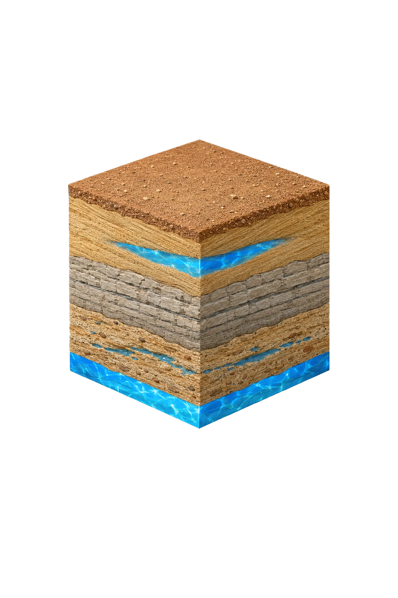
PGCD’s job is to manage the Trinity aquifer system and the overlying Woodbine across all four of those counties under Texas Water Code Chapter 36. That means a uniform rule set across the District, but with local geology that varies sharply between the western outcrop areas and the eastern downdip areas of Johnson County.
Permit Process: Step by Step
| Step | Action | Who Is Responsible |
|---|---|---|
| 1 | Hire a TDLR-licensed water well driller | Property owner |
| 2 | Submit PGCD registration (and operating permit application if non-exempt) before drilling | Licensed driller |
| 3 | Receive written approval — do not begin drilling before this | PGCD |
| 4 | Drill the well in compliance with PGCD approval and TDLR standards | Licensed driller |
| 5 | File the state well report with TDLR within 60 days | Licensed driller |
Exempt vs. Non-Exempt Wells in Johnson County
PGCD operates on a capacity-based exempt structure under Rule 2.1, not on the Texas Water Code state default of 25,000 gallons per day.
A household well is exempt from the operating permit, water-use fees, metering, and production reports if its production capacity is 17.36 gpm or less AND it is used solely for domestic, livestock, or poultry purposes. The same threshold applies to wells used for non-public-water purposes under other conditions in Rule 2.1.
What “exempt” does not mean:
- Registration is still required. All wells drilled on or after April 1, 2011 must be registered with PGCD before drilling, exempt or not.
- TDLR licensure is still required for the contractor who drills the well.
- The state well report to TDLR is still required, filed by the driller within 60 days of completion.
Non-exempt wells — irrigation at higher capacity, commercial supply, public water systems, and similar uses — must obtain an Operating Permit, install a totalizing non-resettable flow meter, and file Monthly Water Production Reports with PGCD.
Minimum Tract Size and Spacing
For wells drilled or completed after May 15, 2017, PGCD requires a 2-acre minimum tract for the property the well serves. For a single domestic well serving multiple households, that 2-acre minimum is multiplied by the number of households served.
Spacing under Rule 4.3:
- New wells at 17.36 gpm or less must generally be at least 100 feet from existing wells completed in the same aquifer layer and at least 50 feet from the property line.
- New wells over 17.36 gpm must meet calculated spacing limiting drawdown impact at property lines to no more than 10 percent, and must be at least twice that property-line distance from other same-layer wells.
Spacing exceptions can be considered by the General Manager when adequate space is unavailable on a tract, or referred to the Board.
Fees
PGCD’s administrative and water-use fees are set annually by the Board and posted on the District Fees page at prairielandsgcd.org. Before your driller files paperwork, ask them to confirm the current registration fee, operating permit application fee, and per-1,000-gallon water-use fee directly from PGCD’s published schedule. PGCD also applies a 50% surcharge for groundwater transported outside the District, with retail-public-utility exceptions.
Burleson and Cresson: Confirm Which Side of the Line You’re On
Two locations in or near Johnson County straddle GCD boundaries, and the rules differ between the districts:
- Burleson straddles the Johnson and Tarrant county line. Johnson-side parcels fall under Prairielands GCD; Tarrant-side parcels fall under Northern Trinity GCD.
- Cresson straddles Parker, Hood, and Johnson. The Parker and Hood sides are Upper Trinity GCD; the Johnson side is Prairielands GCD.
In both cases, groundwater jurisdiction follows the physical location of the well bore — not the city limits, not the mailing address, and not which county the parcel is platted in. Confirm the well bore’s coordinates against the county appraisal or GIS parcel map before assuming which rules apply.
Working With a Licensed Driller
All water wells in Texas must be drilled by a contractor holding a valid TDLR Water Well Driller license. In Johnson County, an experienced driller will review TWDB submitted well reports for neighboring properties, estimate likely depth and yield from the local Trinity unit pattern (which varies sharply between western outcrop areas and eastern downdip areas), and handle the PGCD registration and any required permit application on your behalf.
DFW Well Service is licensed to drill throughout Johnson County — from Burleson and Joshua to Cleburne and across the Brazos River corridor. Call us at (940) 536-8560 to discuss your property and get a site-specific estimate.