Water Well Drilling & Pump Repair in Sanger, TX | DFW Well Service
Service Area Overview
Licensed well drilling and pump service in Sanger and northern Denton County, reaching the Trinity aquifer's Antlers Formation sands.

DFW Well Service provides water well drilling, pump repair, and inspection services throughout Sanger and the northern Denton County area. Sanger straddles the rural-suburban edge — a community of about 9,000 residents where acreage tracts, small farms, and newer residential developments share the landscape. Properties outside the city’s service area depend on private wells, and maintaining those wells is a year-round need.
Services We Provide in Sanger
Well Depth & Geology in the Sanger Area
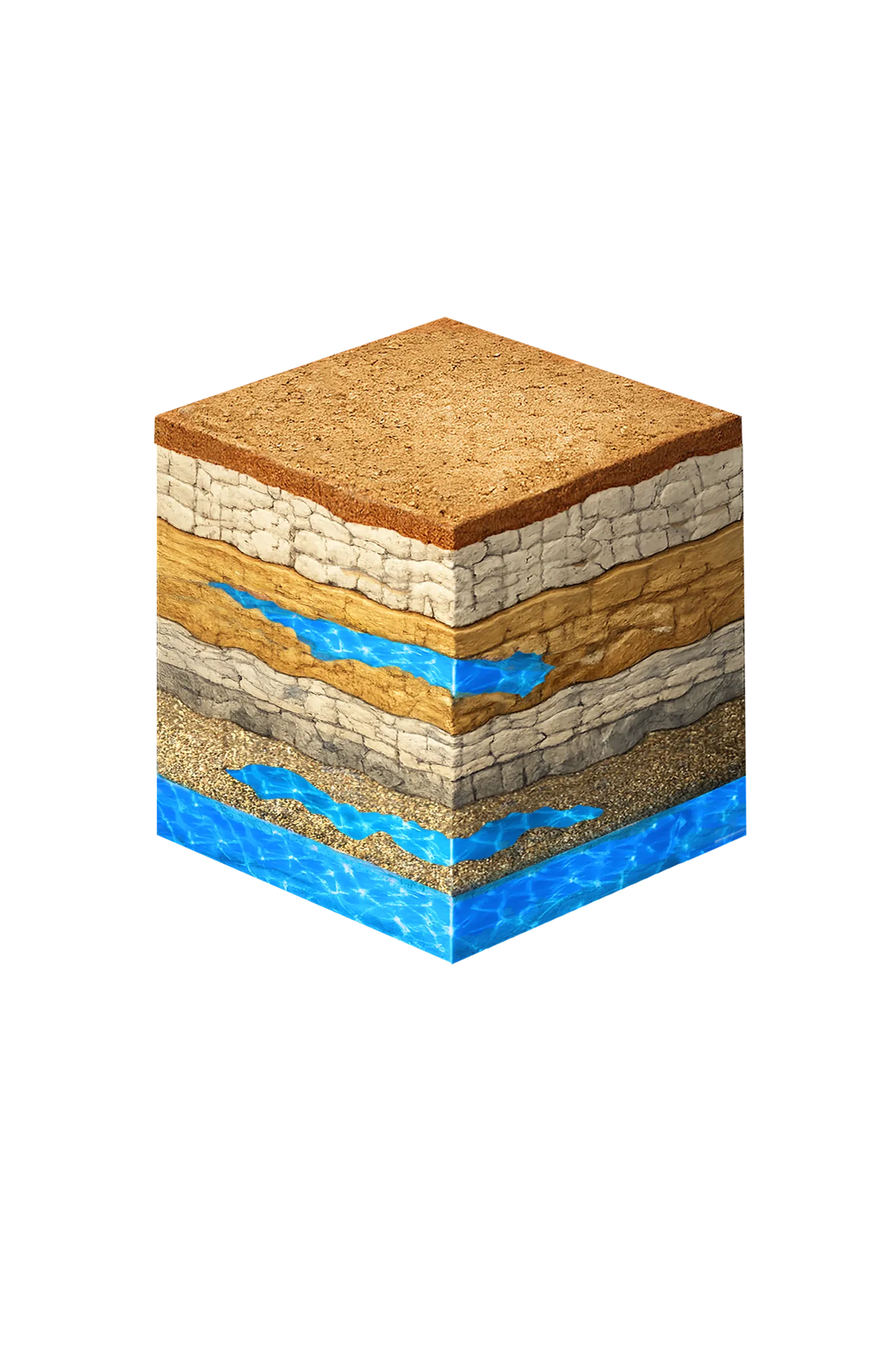
Tap any layer in the cube — or in the list below — to see what it is and what it means for drilling a well here.
- Topsoil — Cross Timbers transition0–15 ft
- Comanche Peak / Walnut limestone15–80 ft
- Paluxy Formation80–250 ft
- Glen Rose Formation250–350 ft
- Twin Mountains Formation350–450 ft
This cross-section shows the layer stack typical of Denton County. The exact formations and depths under a specific Sanger-area property vary — see the details above.
- Primary Aquifer
- Trinity (Paluxy / Glen Rose / Twin Mountains; Antlers in northern Denton County)
- Typical Well Depth
- Varies by location
- Groundwater District
- North Texas GCD
- Confinement
- confined; outcrop in far western Denton County
Secondary: Woodbine (eastern Denton County)
We estimate from nearby well records
Denton County overview → Permit & regulations → TDLR License #61234 DKMPW Updated June 4, 2026
Wells around Sanger draw from the Trinity aquifer, and how the layers stack changes what your driller targets here. In this northwestern corner of Denton County, near the Cooke County line, the Glen Rose Limestone has thinned to nothing, so the Trinity’s two sand layers — the Paluxy and the Twin Mountains — merge into a single unit geologists call the Antlers Formation. That means wells here target the Antlers directly, rather than drilling through a separate Paluxy, Glen Rose, and Twin Mountains stack the way wells do farther south in the county. The Woodbine — a shallower water-bearing layer — is present in parts of northern Denton County and can be productive at shallower depth on some parcels.
Drilling costs in Denton County typically run $38–$50 per foot, with formation hardness influencing where in that range your project falls.
Denton County Permit Requirements
All new wells in Denton County require a pre-drilling permit through the North Texas Groundwater Conservation District. This applies to exempt domestic wells as well as non-exempt production wells. For more information on the permitting process, see our guide to Denton County water well regulations.
DFW Well Service (TDLR License #61234 DKMPW) is ready to help with well drilling or pump service in the Sanger area. Call (940) 536-8560 for a free estimate.