Denton County Water Well Regulations & Permit Requirements, TX
Quick Answer
Denton County is in the North Texas GCD. Registration must be approved and the fee paid before any new well is drilled, including exempt domestic wells.
Planning a well in Denton County?
Local requirements can vary by property, groundwater conservation district, and intended use. We can help you understand the practical next steps. We do not provide legal advice.
Which GCD Governs Denton County?
Denton County is fully within the North Texas Groundwater Conservation District (NTGCD), which also covers Collin and Cooke counties. NTGCD was created by the Texas Legislature in 2009 under Special District Local Laws Code Chapter 8856, and it operates under Texas Water Code Chapter 36. The district’s current rules (as amended February 11, 2020) and its current fee schedule are published at northtexasgcd.org.
NTGCD rules apply uniformly across the entire county. The same registration, exempt structure, spacing table, and fee structure apply whether your parcel is in western Denton County near Argyle or eastern Denton County near Aubrey.
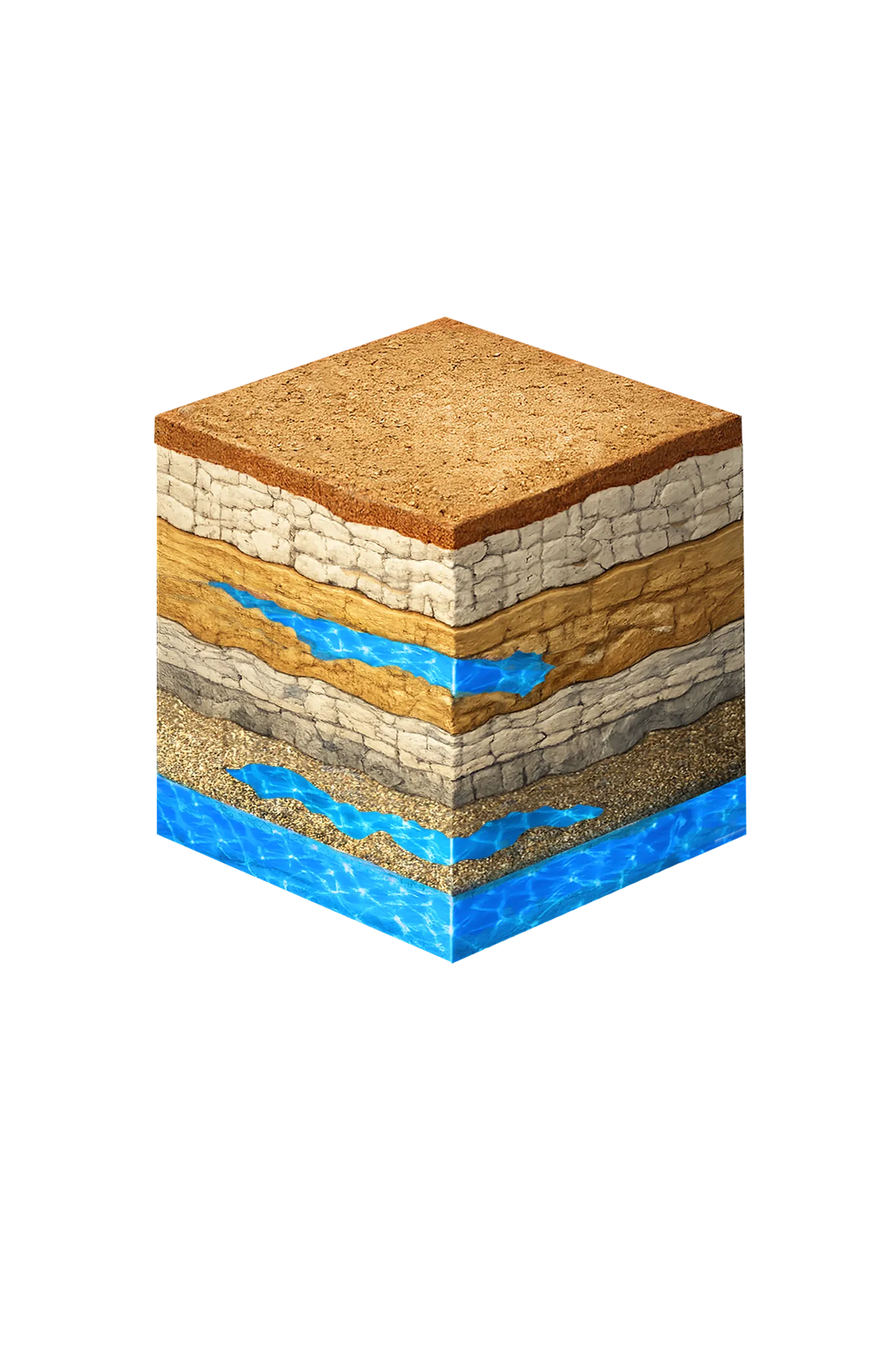
Denton County is geologically split east to west. Eastern Denton County properties typically involve the Woodbine aquifer; western Denton County properties more commonly target the Trinity. That affects depth, expected yield, and water-quality profile — but it does not change the regulatory rules. The NTGCD process is the same on either side of the county.
Step-by-Step: Drilling a Well in Denton County
| Step | Action | Who Is Responsible |
|---|---|---|
| 1 | Hire a TDLR-licensed water well driller | Property owner |
| 2 | Submit well registration application to NTGCD and pay the registration fee ($250 per well on the current fee schedule) | Licensed driller |
| 3 | Receive registration approval — drilling may not begin before this, even for exempt wells | NTGCD |
| 4 | For non-exempt wells (over 17.36 gpm), also obtain an NTGCD Production Permit under Rule 3.9 | Licensed driller |
| 5 | Drill the well in compliance with spacing and construction requirements | Licensed driller |
| 6 | File the State of Texas Well Report with TDLR within 60 days of completion | Licensed driller |
| 7 | For non-exempt wells, install a meter and begin monthly meter readings with quarterly reporting | Property owner / driller |
Exempt vs. Non-Exempt Wells in Denton County
NTGCD Rule 3.7 sets the exemption structure, and it does not match the Texas Water Code 36.117 statewide default. Exemption is a capacity test, not a use test: a new well is exempt from the Production Permit and production-fee requirements if its capacity, as equipped, is not greater than 17.36 gpm. The use of the water does not matter, and the district imposes no minimum tract size.
The flip side is that wells over 17.36 gpm are non-exempt even when used for domestic, livestock, or agricultural purposes. Non-exempt agricultural wells are metered and reported like any other non-exempt well, though they pay a reduced production fee ($1 per acre-foot instead of the volume-based rate).
The statewide default of 25,000 gallons per day from Texas Water Code 36.117 is not the operative rule in Denton County. NTGCD uses a capacity test (17.36 gpm), not a daily-volume test. The 25,000 gpd figure is the state default and does not apply here; the local rule is the 17.36 gpm capacity test.
Exempt wells still require registration before drilling, still must meet the Rule 4.2 spacing requirements, and the driller still files the State of Texas Well Report with TDLR.
Well Spacing Rules
NTGCD Rule 4.2 sets a minimum distance from the property line for every new well, plus a capacity-based minimum distance from existing registered wells completed in the same aquifer:
| Capacity of proposed well | From property line | From existing wells (same aquifer) |
|---|---|---|
| 17.36 gpm or less | 50 ft | 100 ft |
| Greater than 17.36 gpm | 50 ft | 1,175 ft + (1.2 × gpm of proposed well) |
The spacing requirements apply to all aquifers in the district and to exempt and non-exempt wells alike. New wells or well systems with a proposed aggregate capacity of 200 gpm or more also require a hydrogeological report meeting the district’s requirements, and a new well must be drilled within 30 feet of the location approved in the registration.
Fees and Reporting
A non-refundable well registration fee, set under NTGCD Rule 9.12, applies to every new well, including exempt wells. On the district’s current fee schedule (effective August 1, 2025), the fee is $250 per well for wells of 17.36 gpm or less; wells over 17.36 gpm pay a $750 combined registration and Production Permit application fee. Confirm current amounts at northtexasgcd.org before budgeting.
Non-exempt wells also pay water-use fees under Rule 9.2 — currently $0.10 per 1,000 gallons for non-agricultural use up to 10 million gallons per quarter (higher tiers above that), and $1 per acre-foot for agricultural use. Non-exempt wells must be metered, with meter readings recorded monthly (within 10 days of the last day of each month) and production reported quarterly: each quarter’s report is due within 30 days after the quarter ends, and fee payment is due within 60 days of the end of the quarter.
Long-Term Drawdown in Denton County
Denton County is worth a separate note. Groundwater Management Area 8’s Desired Future Conditions project the most severe long-term Trinity drawdown of any GMA 8 county across Denton County: 752 feet in the Twin Mountains and 558 feet in the Paluxy by 2080. NTGCD rules, including the registration requirement for every new well, sit on top of that long-term trajectory. If you are drilling a deep Trinity well in Denton County for a long service life, it is worth discussing with your driller whether to design for current static water levels or for projected drawdown.
Working With a Licensed Driller
All water wells in Texas must be drilled by a contractor holding a valid TDLR Water Well Driller license. In Denton County, where geology shifts substantially east to west and many properties are also on municipal water, an experienced driller will review TWDB records for nearby wells, assess whether the Woodbine or the Trinity is the right target for your parcel, and handle the NTGCD registration and (if applicable) Production Permit paperwork.
DFW Well Service (TDLR License #61234 DKMPW) drills throughout Denton County — from Argyle, Sanger, and Krum on the western side to Aubrey, Pilot Point, and Little Elm on the eastern side. Call us at (940) 536-8560 to discuss your property and get a site-specific estimate.