Need well service in Denison?

DFW Well Service helps property owners with water well drilling, pump service, inspections, and related well issues across North Texas.

Welcome to Denison, TX — DFW Well Service serves Denison and Grayson County

Water Well Drilling & Pump Repair in Denison, TX | DFW Well Service

Service Area Overview

DFW Well Service drills and services wells in Denison and Grayson County near Lake Texoma. Red River GCD governs permitting; depth varies by parcel.

DFW Well Service provides water well drilling, pump repair, and inspection services in Denison and throughout the Grayson County area. Denison sits near the Red River along the Oklahoma border, best known as the home of Lake Texoma and as the birthplace of President Eisenhower. Rural and recreational properties throughout the Denison area depend on private wells for reliable water, and our team is ready to help with new installations and service work.

Services We Provide in Denison

Well Depth & Geology in the Denison Area

Isometric geological cross-section cube illustration showing Grayson County, Texas stratigraphy — Topsoil, Upper Cretaceous units above Woodbine (Pawpaw Fm, Eagle Ford Shale, Austin Chalk), Woodbine Formation / Woodbine Aquifer, Fredericksburg/Washita interval, and the Woodbine aquifer at the base.

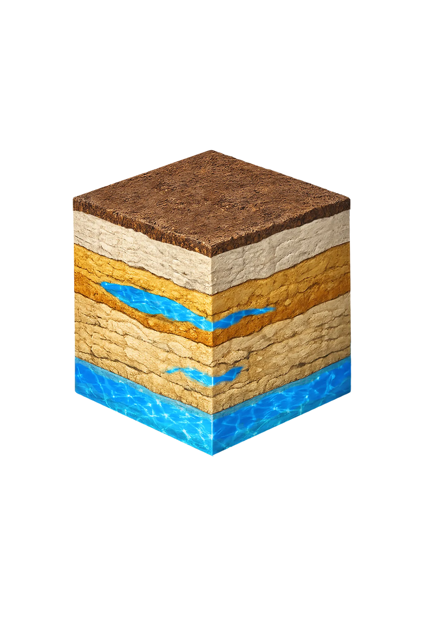
Tap any layer in the cube — or in the list below — to see what it is and what it means for drilling a well here.

  1. Topsoil — Blackland to Post Oak transition
    0–15 ft
  2. Austin Chalk margin
    15–60 ft
  3. Woodbine Formation
    60–250 ft
  4. Trinity (Antlers Formation)
    250–350 ft
Tap or hover a layer in the cube to see what's beneath the surface here.

This cross-section shows the layer stack typical of Grayson County. The exact formations and depths under a specific Denison-area property vary — see the details above.

Explore the full Grayson County geology →

Primary Aquifer
Woodbine

Secondary: Trinity (Antlers)

Typical Well Depth
Varies by location

We estimate from nearby well records

Groundwater District
Red River GCD
Confinement
outcrop in a NE-SW band through central and eastern Grayson County; dips eastward into Fannin/Lamar/Red River counties

Grayson County overview → Permit & regulations → TDLR License #61234 DKMPW Updated June 4, 2026

Wells around Denison draw from the Trinity aquifer, with the Woodbine as a secondary source where present. Because the Glen Rose Limestone is absent across Grayson County, the Trinity here takes the form of the Antlers Formation — the Paluxy and Twin Mountains sands merged into one unit. Lake Texoma adds some recharge to the Trinity where the aquifer reaches the surface in the lake, and along the river the Red River alluvium can be a localized source with moderate to large supply potential.

Drilling rates in Grayson County ($28–$40/ft) are among the more affordable in the region.

Grayson County Permit Requirements

All new wells in Grayson County require a pre-drilling permit through the Red River Groundwater Conservation District. The RRGCD sets standards for well construction, spacing, and production across the county. For complete detail on the permitting process, see our guide to Grayson County water well regulations.

DFW Well Service (TDLR License #61234 DKMPW) serves Denison and the surrounding Lake Texoma region for well drilling and pump service. Call (940) 536-8560 for a free estimate.

Frequently Asked Questions

Which groundwater district covers Denison?
Denison is in Grayson County, which falls under the Red River Groundwater Conservation District (RRGCD). A permit is required before drilling a new well. DFW Well Service submits the permit application on your behalf as part of the project.
How deep are water wells near Denison?
There's no single typical depth around Denison — it varies meaningfully from one property to the next, so we review the driller's logs from neighboring wells before quoting a depth. Denison sits in northern Grayson County near Lake Texoma and the Red River, so wells here may hit the Trinity at or near the surface — that's the Antlers Formation, the Paluxy and Twin Mountains sands merged into one where the Glen Rose is absent — or the Woodbine where present, or Red River alluvium near the river.
Are there special considerations for wells near Lake Texoma?
Properties near Lake Texoma require attention to setback requirements from surface water bodies, as Texas well construction standards require minimum distances from lakes, streams, and drainage features. Your well location may need to account for these setbacks. We assess each site individually.
What does well drilling cost near Denison?
Grayson County drilling rates run $28–$40 per foot. Total cost depends on completion depth and the full system (casing, grouting, pump, pressure tank). We provide a free itemized written estimate after reviewing neighboring driller's logs for your parcel.
Can you work on well and pump systems for rural lake-area properties?
Yes. We regularly serve rural and recreational properties in the Denison and Lake Texoma area, including pump replacements, pressure tank service, and well rehabilitation. Lake-area properties with seasonal or vacation use sometimes have unique pump demands — we can size your system appropriately.
My well has been unused for years — can it be brought back into service?
Potentially yes, depending on its construction condition and current yield. We can inspect and test an idle well, rehabilitate it if warranted, and bring it back into service. In some cases, rehabilitation is more economical than drilling a new well. Call us to discuss your situation.
Is the well water in Denison salty or brackish?
Usually fresh. The Woodbine around Denison is fresh through the band where it reaches the surface (its outcrop), and Texas Water Development Board mapping shows fresh water reaching unusually far downdip — farther down where the layer tilts deeper — staying fresh to about 1,500 feet before turning slightly to moderately saline. Iron and manganese are the routine treatment items.

Request Service

Tell us about the property and what you need help with.

Fields marked * are required.