Need well service in Corsicana?

DFW Well Service helps property owners with water well drilling, pump service, inspections, and related well issues across North Texas.

Welcome to Corsicana, TX — DFW Well Service serves Corsicana and Navarro County

Water Well Drilling & Pump Repair in Corsicana, TX | DFW Well Service

Service Area Overview

Licensed well drilling and pump service in Corsicana and Navarro County, where no local GCD operates and TDLR standards govern all well construction.

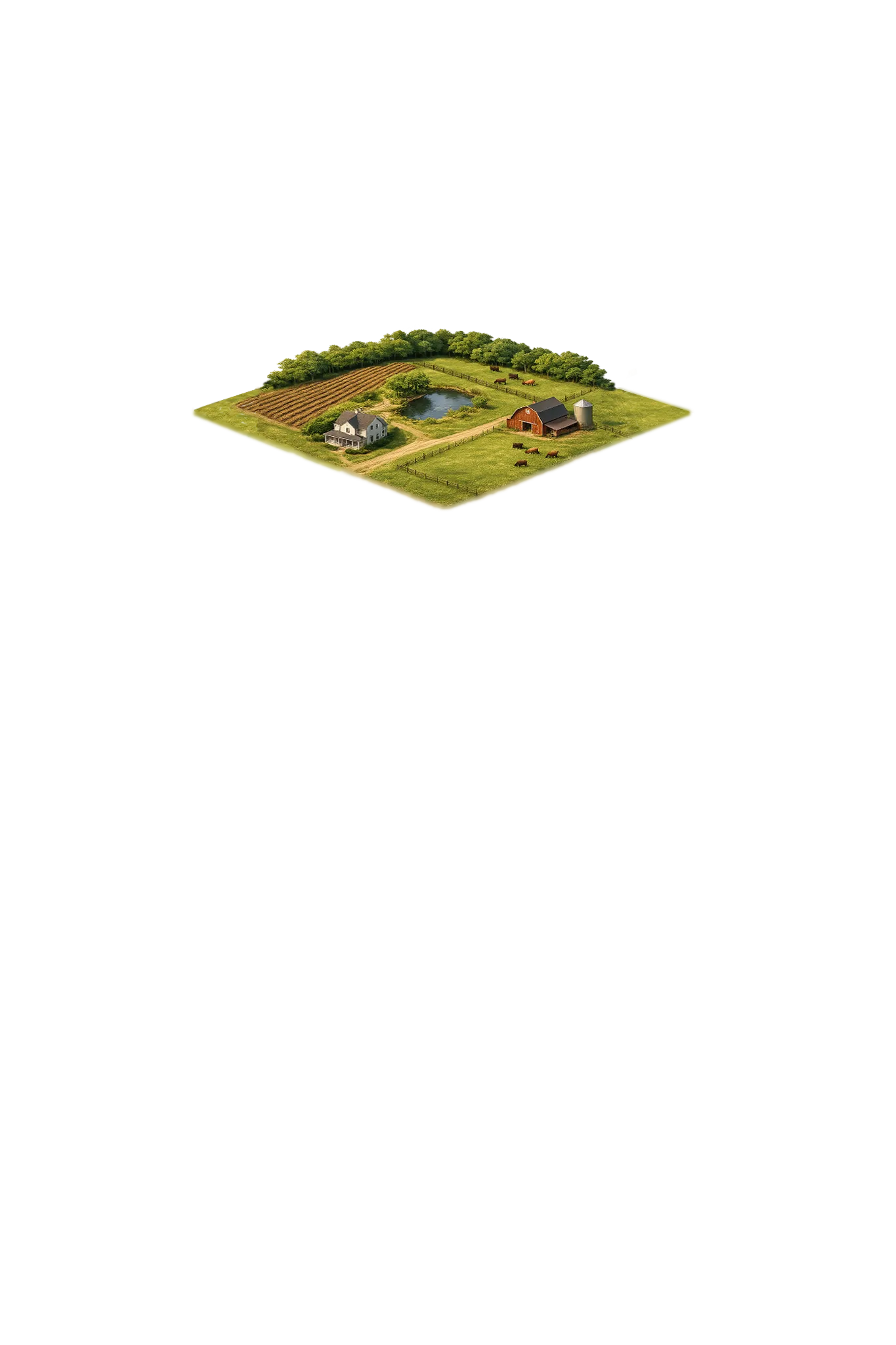
Most of Corsicana itself runs on city surface water from Lake Halbert, not on well water. A private well here is the exception, not the norm — it is mainly an option on rural Navarro County tracts where city water does not reach, and that is part of why solid local well data is thin.

Services We Provide in Corsicana

DFW Well Service provides licensed water well drilling and pump services to Corsicana and the rural parts of Navarro County. As a TDLR-licensed well driller (License #61234 DKMPW), we meet all state standards for well construction in counties — like Navarro — that operate without a local groundwater conservation district. Corsicana sits on geology found almost nowhere else we work: the Navarro Group, with the local aquifer being the Nacatoch Sand rather than the Trinity or Woodbine that supply most of North Texas.

Well Depth & Geology in Corsicana Area

Isometric geological cross-section cube illustration showing Navarro County, Texas stratigraphy — Topsoil, Navarro Group clays and marls (Corsicana Marl, Kemp Clay), Nacatoch Sand, Taylor Group / Austin Chalk / Eagle Ford / Woodbine, Trinity Group, and the Nacatoch Sand aquifer at the base.

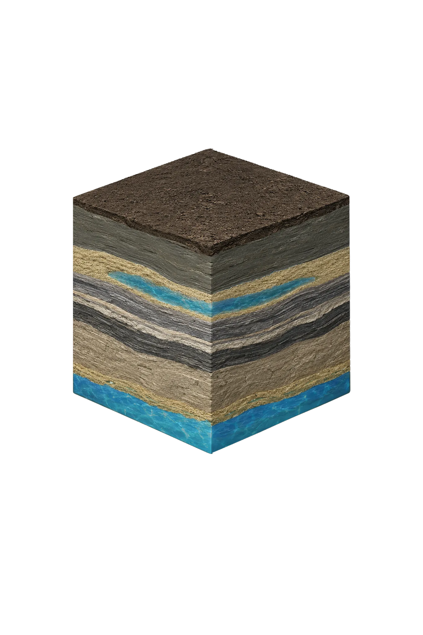
Tap any layer in the cube — or in the list below — to see what it is and what it means for drilling a well here.

  1. Topsoil — Blackland Prairie (deep southern extension)
    0–15 ft
  2. Navarro Group clays and marls (Corsicana Marl, Kemp Clay)
    15–varies
  3. Nacatoch Sand
    100–800 (depending on outcrop position) ft
  4. Taylor Group / Austin Chalk / Eagle Ford / Woodbine
    deep
  5. Trinity Group
    very deep
  6. Carrizo-Wilcox (Carrizo Formation, Wilcox Group)
    200–600 (far SE corner only) ft
Tap or hover a layer in the cube to see what's beneath the surface here.

This cross-section shows the layer stack typical of Navarro County. The exact formations and depths under a specific Corsicana-area property vary — see the details above.

Explore the full Navarro County geology →

Primary Aquifer
Nacatoch Sand

Secondary: Carrizo-Wilcox (far SE corner of the county only)

Typical Well Depth
100–800 ft
Groundwater District
No GCD — TDLR standards only
Confinement
outcrop across central and eastern Navarro County; dips SE at roughly 40–100 ft/mile

Navarro County overview → Permit & regulations → TDLR License #61234 DKMPW Updated June 4, 2026

Corsicana sits squarely on the Navarro Group — in fact, the area is the type locality for it. The Corsicana Marl, the rock unit geologists named after the town, has its reference site about two miles south of the courthouse. For a property owner, the practical point is this: the local aquifer here is the Nacatoch Sand, a unit of the Navarro Group, not the Trinity and not the Woodbine.

Residential wells in and around Corsicana typically target the Nacatoch at relatively shallow depths, often in the range of 150 to 300 feet, though yields are usually modest — commonly 5 to 20 gallons per minute. The Nacatoch dips to the southeast across the county, so wells get deeper in that direction. Two formations that show up on a lot of generic North Texas well descriptions do not apply to Corsicana: the deep Trinity is brackish and far too deep to be a routine target this far east, and the Carrizo-Wilcox aquifer only enters Navarro County in its very southeastern corner, not under Corsicana. Properties west of where the Nacatoch reaches the surface (its outcrop), toward the Hill County line, can face dry holes or cost-prohibitive deeper targets.

Navarro County has no active groundwater conservation district, which means well permitting follows TDLR state rules rather than a local district process. You are not required to obtain a GCD permit before drilling. However, your driller must be TDLR-licensed, construction must meet the Texas Well Construction Standards (16 TAC Chapter 76), and a Well Report (Form WR-1) must be filed with TDLR after completion. For a complete overview of the process, see our guide to Navarro County water well regulations.

DFW Well Service is fully licensed and handles all required TDLR reporting on your behalf. Call (940) 536-8560 for a free estimate on any new well or service project in Corsicana or Navarro County.

Frequently Asked Questions

Is there a groundwater conservation district in Corsicana or Navarro County?
No. Navarro County does not have an active groundwater conservation district. This means well construction is governed solely by the Texas Department of Licensing and Regulation (TDLR) and state water law. You do not need a GCD permit, but TDLR construction standards still apply and must be followed by your licensed driller.
How deep are water wells typically drilled near Corsicana?
Most Corsicana-area wells reach water at roughly 150 to 300 feet, completing in the Nacatoch Sand — the principal local aquifer across central and eastern Navarro County. Yields are modest, often 5 to 20 gallons per minute. The Woodbine lies far deeper and is brackish in most of the county, so it isn't a routine residential target. Because depth and yield shift across the county, we confirm against nearby driller's logs before quoting.
What aquifer supplies wells in the Corsicana area?
The Nacatoch Sand, part of the Navarro Group. Corsicana is actually the namesake location for this geology — the Corsicana Marl's reference site is just south of town. The Nacatoch is the practical local aquifer for residential wells, usually reached at 150 to 300 feet with modest yields. The Trinity is too deep and brackish to be a routine target here, and the Carrizo-Wilcox only reaches the far southeastern corner of the county, not Corsicana.
What does well drilling cost in Navarro County?
Cost for a Corsicana-area well depends on depth to the Nacatoch on your specific property and the yield it produces, which varies across the county. Because Nacatoch wells tend toward modest yields and depth changes with location, we give a free written estimate after looking at your property and nearby well records rather than quoting a flat per-foot figure.
Does Corsicana's oil history affect well water quality?
Navarro County is one of the oldest oil-producing areas in Texas, and historical oil operations have affected shallow groundwater in some locations, so a comprehensive water test — including hydrocarbons — is wise for any new well. Beyond that, Nacatoch water in the Corsicana area tends to be soft and sodium-bicarbonate in character rather than the hard, calcium-rich water typical of Trinity wells further west, and total dissolved solids commonly run in the 500 to 1,500 mg/L range. We recommend a full water quality test after any new well so you know exactly what you've got.
How do I know if my rural Corsicana property needs a well?
Properties outside Corsicana city limits and the smaller towns often do not have access to a public water supply. If your deed or property survey shows no utility water service and the county road district cannot confirm service, a private well is likely your best option. We can help assess the feasibility before you commit.
Can you repair or replace a pump on an existing Navarro County well?
Yes. Pump repair and replacement is one of our core services. Whether your submersible pump has failed, your pressure tank is waterlogged, or your system is losing prime, our technicians can diagnose and fix the problem. Call (940) 536-8560 to schedule a service call.
Is the well water in Corsicana salty or brackish?
Often, the deeper or farther southeast you go. Corsicana's local aquifer is the Nacatoch Sand (about 150 to 300 feet in town); Texas Water Development Board mapping shows it is fresh near its outcrop (where the sand reaches the surface) but slightly salty across its downdip (southeastern) extent, and the deep Trinity below is brackish. Always test total dissolved solids — a measure of how mineral-heavy the water is — before relying on a well here.

Request Service

Tell us about the property and what you need help with.

Fields marked * are required.