Somervell County Water Well Regulations & Permit Requirements, TX
Quick Answer
Somervell County is in the Prairielands GCD. PGCD registration is required for all new wells, including exempt household wells under 17.36 gpm capacity.
Somervell County sits along the Brazos River southwest of the DFW metroplex, with Glen Rose as the county seat. The Glen Rose Formation — the same limestone unit you see exposed in the dinosaur tracks at Dinosaur Valley State Park — is the bedrock here, and it shapes both the drilling experience and the water you bring up. Your regulatory starting point is the Prairielands Groundwater Conservation District.
Which GCD Governs Somervell County?
Somervell County is fully within the Prairielands Groundwater Conservation District (PGCD), which also covers Ellis, Hill, and Johnson Counties. PGCD was created in 2009 by the 81st Texas Legislature under Texas Special District Local Laws Code Chapter 8855. The District’s office is at 208 Kimberly Drive in Cleburne (Johnson County), and its current rules are dated April 21, 2025 and posted at prairielandsgcd.org.
PGCD manages the Trinity aquifer and the localized Brazos River Alluvium across all four of its counties under Texas Water Code Chapter 36.
Permit Process: Step by Step
| Step | Action | Who Is Responsible |
|---|---|---|
| 1 | Hire a TDLR-licensed water well driller | Property owner |
| 2 | Submit PGCD registration (and operating permit application if non-exempt) before drilling | Licensed driller |
| 3 | Receive written approval — do not begin drilling before this | PGCD |
| 4 | Drill the well in compliance with PGCD approval and TDLR standards | Licensed driller |
| 5 | File the state well report with TDLR within 60 days | Licensed driller |
Exempt vs. Non-Exempt Wells in Somervell County
PGCD operates on a capacity-based exempt structure under Rule 2.1, not on the Texas Water Code state default of 25,000 gallons per day.
A household well is exempt from the operating permit, water-use fees, metering, and production reports if its production capacity is 17.36 gpm or less AND it is used solely for domestic, livestock, or poultry purposes.
What “exempt” does not mean:
- Registration is still required. All wells drilled on or after April 1, 2011 must be registered with PGCD before drilling, exempt or not.
- TDLR licensure is still required for the contractor who drills the well.
- The state well report to TDLR is still required, filed by the driller within 60 days of completion.
Non-exempt wells must obtain an Operating Permit, install a totalizing non-resettable flow meter, and file Monthly Water Production Reports with PGCD.
Minimum Tract Size and Spacing
For wells drilled or completed after May 15, 2017, PGCD requires a 2-acre minimum tract for the property the well serves. For a single domestic well serving multiple households, that 2-acre minimum is multiplied by the number of households served.
Spacing under Rule 4.3:
- New wells at 17.36 gpm or less must generally be at least 100 feet from existing wells completed in the same aquifer layer and at least 50 feet from the property line.
- New wells over 17.36 gpm must meet calculated spacing limiting drawdown impact at property lines to no more than 10 percent, and must be at least twice that property-line distance from other same-layer wells.
Fees
PGCD’s administrative and water-use fees are set annually by the Board and posted on the District Fees page at prairielandsgcd.org. The fee schedule includes a registration fee for new wells, an operating permit application fee for non-exempt wells, a per-1,000-gallon water-use fee on non-exempt non-agricultural production, a per-acre-foot rate on agricultural use, and a 50% surcharge for groundwater transported outside the District. Confirm the current rates from PGCD’s published schedule before applying.
Glen Rose Is Not Just a Service-Area Name
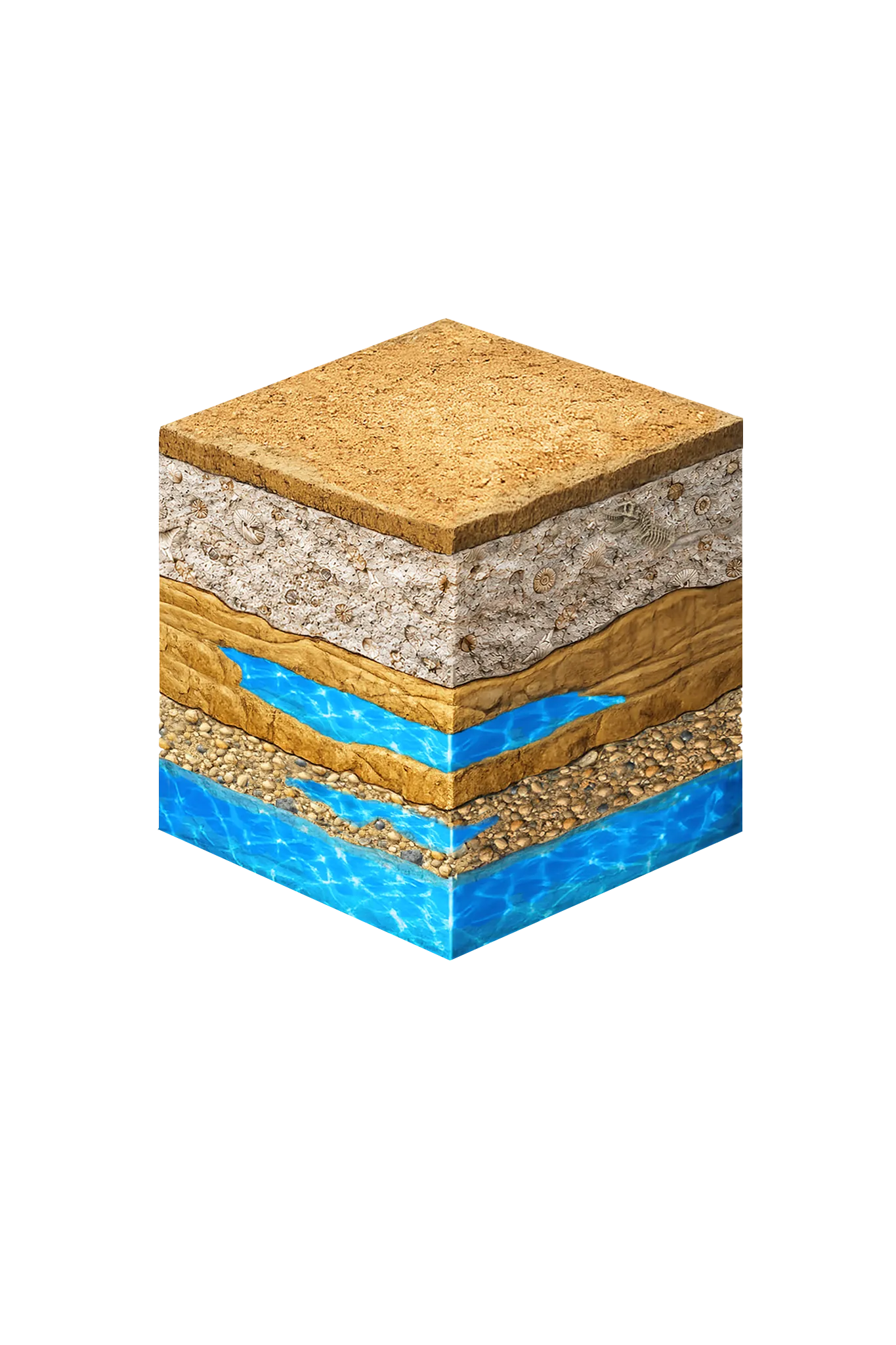
Glen Rose is a reference point in Texas geology. The Glen Rose Formation is named for Glen Rose, Somervell County, Texas — the type locality designated by Robert T. Hill in 1891 and recorded in the USGS Geolex. Drilling here puts you in the middle of that named unit, often at the surface or within the first few feet.
Practical implications for your well:
- The Glen Rose Formation is mostly limestone with shale and marl interbeds. Limestone is not generally permeable; productive water in Glen Rose intervals usually comes from fractured and solutioned zones rather than from porous sand.
- Drilling equipment matters. Crews working in Glen Rose terrain often need air-rotary or hammer bits rather than the mud-rotary equipment used in sandy formations to the east.
- Some shallow wells produce from crevices and solution channels in limestone near the base of the Glen Rose Formation, fed by leakage from the underlying Trinity reservoir. Yields from these shallow zones can be small and uneven.
- Deeper, more reliable supplies generally come from the basal Trinity sands beneath the Glen Rose — the Hensell and Hosston units in PGCD planning terminology, which is the Twin Mountains Formation in standard north-central Texas naming.
Working With a Licensed Driller
All water wells in Texas must be drilled by a contractor holding a valid TDLR Water Well Driller license. In Somervell County, experience with Glen Rose limestone matters as much as licensure. An experienced driller will review TDLR submitted well reports for nearby properties, choose the right rig and bits for limestone, evaluate whether a shallow fractured-Glen Rose completion or a deeper basal-Trinity completion makes more sense for your parcel, and handle PGCD registration and any required permit application on your behalf.
DFW Well Service is licensed to drill throughout Somervell County, with a working knowledge of Glen Rose and basal Trinity completions. Call us at (940) 536-8560 to discuss your property and get a site-specific estimate.